
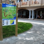
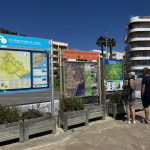
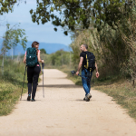
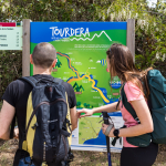

The Tordera Route section between Malgrat de Mar and Blanes, which is between 10 and 11 kilometres in length depending on the variant you choose, allows you to connect these two municipalities while following the Tordera River upstream for a few kilometres and provides access to visit the mouth of the Tordera. The route begins in front of Malgrat de Mar railway station, where you will find the route information panel. Following the directions on the first waymark located on the panel, you will head towards the beaches and the mouth of the Tordera. The section ends in Blanes, in front of Sa Palomera and the Tourist Office, where you will also find a route information panel.
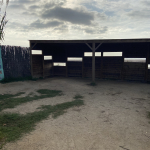
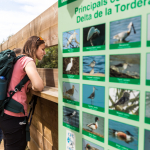
During the route, you will have the opportunity to make a detour to the mouth of the Tordera, which is located 1,400 metres from the route on the Malgrat side and allows you to observe this protected natural area from a birdwatching hide. Along this section, much of the route follows paths separated from traffic, while the remainder runs along very low-traffic roads or through urban areas. However, in the market garden area of Malgrat, after leaving the beaches behind, the route follows the Camí del Pla and Camí de Mas Bages, on a paved road shared with vehicles. Please remember that throughout the route you should not leave the marked path, always follow the route signage, and respect all safety recommendations as well as the natural environment at all times.
Variant 1 (long route – via the Palafolls road bridge)
The two route variants we propose for travelling from Malgrat de Mar to Blanes are practically identical; the only difference is the point where the Tordera River is crossed.
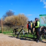
To follow Variant 1 of the Tourdera section between Malgrat de Mar and Blanes, shared by both hikers and cyclists, you will cover a total of 11 kilometres, with virtually no elevation gain or loss, making the overall difficulty of the route very low. At the start of the route, in front of Malgrat de Mar railway station, you will find a route information panel, nearby parking facilities and all the services offered by a tourist town such as Malgrat, including shops, bars, restaurants, accommodation and more. This variant is approximately one kilometre longer than Variant 2.
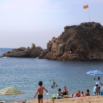
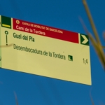
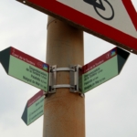
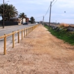
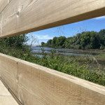
You will begin the route by heading towards the beaches and the mouth of the Tordera, following the direction indicated by the wayfinding marker attached to one of the information panel posts. After a short distance, you will pass through an underpass beneath the railway tracks and reach the seafront promenade of Malgrat. Following the route signs once again, you will pass several beaches and continue to the Passeig de la Pomareda, where the route is very easy to follow, as the path is separated by a wooden fence (if you are cycling, you may use the paved lane). Along this section, you will pass directly behind the dune vegetation (with plant species typical of these environments), which is protected and where access on foot is prohibited.
When you reach the campsite area, you will leave the segregated path and continue along Camí de Mas Bages and Camí del Pla, a section of the route shared with vehicles, so particular attention to traffic is required. Nevertheless, this stretch passes through the market gardens of Malgrat de Mar, in the heart of the Tordera Delta. Following the path, you will reach the Tordera River at the Pla ford area. At this point, the signposts will indicate whether you wish to continue towards the mouth of the Tordera (by taking a detour of just over one kilometre, leading to a viewpoint overlooking the estuary and the protected natural area) or continue directly towards Blanes.
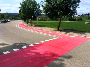
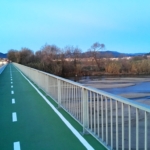
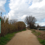
To continue towards Blanes, follow the Tordera River until you reach the GI-682 road (the Palafolls road), which you will pass beneath through a narrow underpass beside the river. Once beyond this point, you will find a signpost offering the option to continue towards Blanes, which you should follow. This direction leads along a path to the roadside, where a cycle lane completely separated from traffic has been created. You will use this cycle lane to cross the Tordera River. On the opposite bank, follow the ramp and the route signs to reach the lower track that leads directly to Blanes.
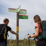
Once back on the route, the signs will guide you towards the urban area of Blanes, also allowing you to make a detour to the mouth of the Tordera and the viewpoints on the Blanes side. Continuing along the route, you will enter Blanes via Avinguda Vila de Madrid, in the well-known Els Pins district, before reaching the seafront promenade of s’Abanell Beach. Throughout the urban section in Blanes, the wayfinding signs are smaller and attached to streetlights or traffic signs, unlike the larger signposts mounted on wooden poles used along the rest of the route. During the entire final stretch along the promenade, both walkers and cyclists should pay attention to the signage, as pedestrians must use the upper promenade while cyclists should follow the cycle lane. The route ends at Plaça Catalunya, in front of the Tourist Office and Sa Palomera, where the route information panel is located and where the Costa Brava is traditionally considered to begin.
Variant 2 (short route – via the Tordera Bridge)
To follow Variant 2 of the Tourdera section between Malgrat de Mar and Blanes, shared by both hikers and cyclists, you will cover a total of 10 kilometres, with virtually no elevation gain or loss, making the overall difficulty of the route very low. At the start of the route, in front of Malgrat de Mar railway station, you will find a route information panel, nearby parking facilities and all the services offered by a tourist town such as Malgrat, including shops, bars, restaurants, accommodation and more. This variant is approximately one kilometre shorter than Variant 1.
You will begin the route by heading towards the beaches and the mouth of the Tordera, following the direction indicated on the sign attached to the route information panel. After a short distance, you will pass through an underpass beneath the railway tracks and reach the seafront promenade of Malgrat. Following the route signs once again, you will pass several beaches and continue to the Passeig de la Pomareda, where the route is very easy to follow, as the path is separated by a wooden fence (if you are cycling, you may use the paved lane). Along this section, you will pass directly behind the dune vegetation (with plant species typical of these environments), which is protected and where access on foot is prohibited.
When you reach the campsite area, you will leave the segregated path and continue along Camí de Mas Bages and Camí del Pla, a section of the route shared with vehicles, so particular attention to traffic is required. Nevertheless, this stretch passes through the market gardens of Malgrat de Mar, in the heart of the Tordera Delta. Following the path, you will reach the Tordera River at the Pla ford area. At this point, the signposts will indicate whether you wish to continue towards the mouth of the Tordera (by taking a detour of just over one kilometre, leading to a viewpoint overlooking the estuary and the protected natural area) or continue directly towards Blanes.
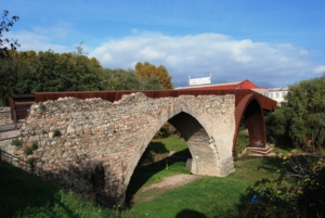
To continue towards Blanes, follow the Tordera River until you reach the GI-6831 road between Malgrat de Mar and Blanes. Here, you will cross to the Blanes side via the Tordera Bridge and take the first signposted turning on the right, which will lead you towards the urban area of Blanes. Before doing so, however, you will have the opportunity to make a detour to the mouth of the Tordera and the viewpoints on the Blanes side. Continuing along the route, you will enter Blanes via Avinguda Vila de Madrid, in the well-known Els Pins district, before reaching the seafront promenade of s’Abanell Beach. Throughout the urban section in Blanes, the wayfinding signs are smaller and attached to streetlights or traffic signs, unlike the larger signposts mounted on wooden poles used along the rest of the route. During the entire final stretch along the promenade, both walkers and cyclists should pay attention to the signage, as pedestrians must use the upper promenade while cyclists should follow the cycle lane. The route ends at Plaça Catalunya, in front of the Tourist Office and Sa Palomera, where the route information panel is located and where the Costa Brava is traditionally considered to begin.
 | Bicicleta | |
|---|---|---|
 | Nivell | Fàcil |
 | Distància | (variant 1) 11 km (variant 2) 10 km |
 | Desnivell + | (variant 1) 15 m (variant 2) 8 m |
 | Desnivell – | (variant 1) 15 m (variant 2) 7 m |
 | Senderisme | |
|---|---|---|
| Nivell | Fàcil |
| Distància | (variant 1) 11 km (variant 2) 10 km |
| Desnivell + | (variant 1) 15 m (variant 2) 8 m |
| Desnivell – | (variant 1) 15 m (variant 2) 7 m |
From Montseny to the Mediterranean—whether by bike or on foot—nature and sports enthusiasts alike can enjoy this route, which offers a unique journey thanks to its diverse landscape and rich heritage.


















